![]()
|
|
| Our mission: |
| Via collaboration, creation of a publicly available photographic database of weather stations and weather station metadata. |
|
NEWS
Updated
07/30/2012 New paper in process, see details here NOTE: Surfacestations.org gallery server has received heavy traffic and some attacks in the last 24hrs. The online image database aka gallery server site has been put into safe mode to secure backups and make it more secure. After months of work, our paper has been accepted, read summaries on the paper at these locations: Dr. Roger Pielke Senior's website here Dr. John Neilsen-Gammon's website here Anthony Watts website here Media Resource - download PDF here Link to the paper (final print quality), Fall et al 2011 here (updated) Fall et all 2011 supplementary information here
Surfacestations project reaches 82.5% of the network surveyed. 1007 of 1221 stations have been examined in the USHCN network. The Google Earth map below shows current coverage.
Sincere thanks to Gary Boden and Barry Wise for this contribution!
The upcoming papers will feature statistical analysis of the nationwide USHCN network in the context of siting.
Direct link to PDF of the report is here
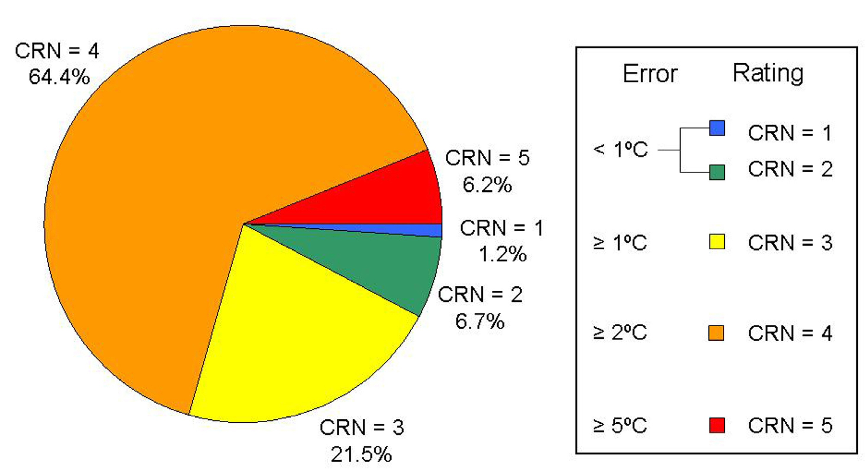
HELP NEEDED FOR SURVEYS IN THE FOLLOWING STATES: Kansas, Nebraska, Arkansas, Illinois, Missouri, North Dakota, Idaho, South Dakota, Texas. Excerpt graphics from the report are
below: Station quality ratings obtained from NOAA/NCDC via this source: Climate Reference
Network Rating Guide - adopted from NCDC Climate Reference
Network Handbook, 2002,
specifications for siting (section 2.2.1) of NOAA's new
Climate Reference Network:
|
Visit the blog to see highlighted examples of poorly sited stations in the "How Not to measure Temperature" series. Site launched on 06/04/07 Progress as of 07/30/2012 USHCN Sites surveyed so far: 1068 USHCN Sites rated so far: 1007 USHCN Sites remaining: 214 "This is a very important need for the climate science
community, and you are encouraged to obtain this photographic
documentation if you can, and also share with the new website
under development by Anthony Watts" Other news: Florida Completed! Nevada USHCN surveys completed California USHCN surveys completed! See all California stations here Louisiana has only three stations left, Franklin, Lafayette, and Plain Dealing Any takers? A look at how changes in paint on Stevenson Screens may have affected temperature measurement. Now Online: Conference presentation given at CIRES/UCAR on 8/29/07 describing this project and the methods used to assign station site quality ratings, along with examples of many site issues seen thus far. Click to view slideshow Special recognition to five volunteers; Bob Thompson, Eric Gamberg, Russ Steele, David Smith, and Don Kostuch, who turned summer travels into survey expeditions. Don Kostuch has surveyed more stations, and covered a broader geographic area than any other surveyor. Thanks to all!
|
||||||
|
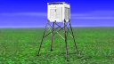
Here is a well maintained and well sited USHCN station: |
|||||||
| Click pictures for complete site surveys of these stations | |||||||
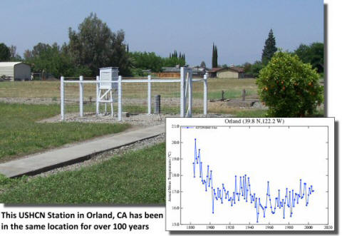
|
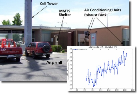
Here is a not-so-well maintained or well sited USHCN station: Graph is from NASA GISS - see it full size This site in Marysville, CA has
been around for about the same amount of time, but
|
|||||||
What you'll find here
|


| © 2007, 2008, 2009 - surfacestations.org, Anthony Watts, and various contributors - see rules and terms of use |